Summer Heat Leads to Spring Chill for Portsmouth, New Hampshire, Parade
🔴 A cooldown begins Friday as a cold front brings possible thunderstorms
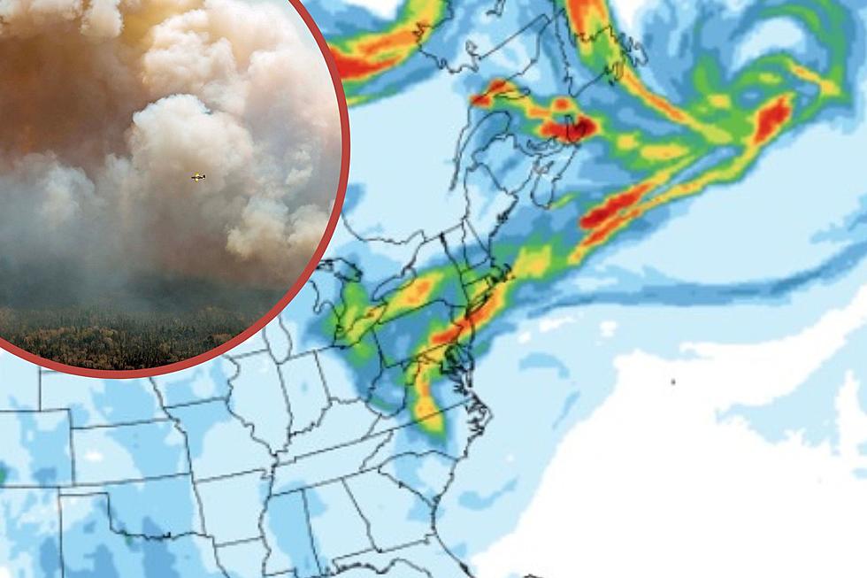
🔴 The wildfire smoke will also leave the northeast
🔴 The parade forecast calls for clouds and showers
At least four wildfires burning in Nova Scotia and temperatures in the 90s will combine for one more Air Quality Action Day Thursday with a cool day for Saturday's Grand Parade.
The New Hampshire Department of Environmental Services said the immediate coastal area will feel the impacts from the Canadian wildfires, which have burned over 46,000 acres and are still considered as burning out of control. Ground level ozone will rise to levels that are unhealthy for sensitive individuals including children and older adults, anyone with lung disease such as asthma, emphysema, and bronchitis, and people who are active outdoors.
Even healthy individuals may experience mild health effects and should consider limiting strenuous or prolonged outdoor activities.
Cooldown Begins Friday
Friday will begin a "pretty substantial change" in the weather with lingering showers and much cooler temperatures by Saturday, according to meteorologist Justin Arnott with the National Weather Service in Gray, Maine.
"Friday we have a cold front that's going to come down. It is going to be hot again, but by afternoon we expect some showers and thunderstorms to form. And that is going to usher in much cooler temperatures for the day on Saturday," Atwood told Seacoast Current.
Thursday's high will be around 90, the mid-80s Thursday, and only the 50s on Saturday, according to Atwood.
Air quality issues from the Nova Scotia wildfires and the heat will be long gone by Saturday.
Contact reporter Dan Alexander at Dan.Alexander@townsquaremedia.com or via Twitter @DanAlexanderNH
These 18 New Hampshire Restaurants Serve Fantastic Eggs Benedict
More From WSHK-WSAK 102.1 & 105.3 The Shark