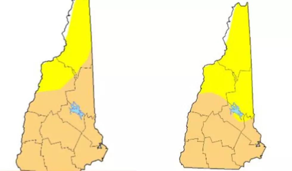
NH Drought Map After 3 Rainy Days
It was the wettest week The Granite State has seen since May and the new drought monitor is in to show just how much things have changed. Hello? Are these the same maps?
People always ask why I freak out every summer as the dry days begin to align. Now you know why! Three days of rain has done almost nothing to alleviate the drought!
Congratulations to the fine people of Carroll County as their entire living area has escaped the clutches of MODERATE DROUGHT and are now only experiencing ABNORMAL DRYNESS.
This is The Seven Lakes Region and as we are going into the heyday of Summer vacation time, this would be the worst possible time to go dry.
I can't imagine the residents of the Route 153 corridor being anything short of horrified by the prospect of changing their name to The Seven Mudpuddle Region. Thankfully, that has been avoided.
The most fortunate region of The Granite State is a tiny sliver of Coos County to the extreme northwest. Merely 1 and a half percent of acreage from Pittsburg to Lancaster has managed to escape the hostile and arid fate that the rest of us are enduring.
I can't help but wonder if someone was really aggressively paddling their kayak down the Connecticut River and the splashing qualified this splinter of North Country into the safe zone.
With nothing but a stray thundershower expected throughout the next 5 or 6 days, I cannot foresee things getting any better soon.
Hopefully, the meteorologists are putting out a 'Chamber Of Commerce' forecast for The Fourth and we continue to see some much needed precipitation.
KEEP READING: Scroll to see what the big headlines were the year you were born
More From WSHK-WSAK 102.1 & 105.3 The Shark


